Broadband Data and Mapping Files
Broadband Market Intelligence
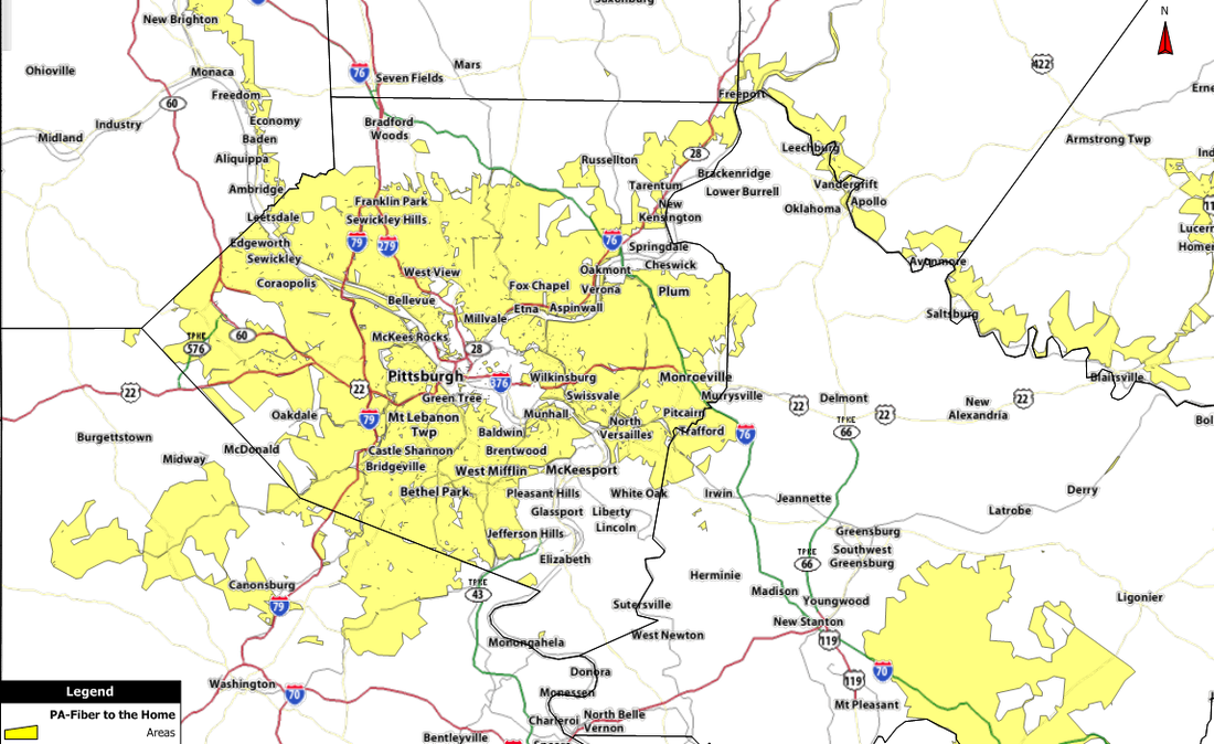
Fiber to the Home Map
(FTTH)
There are many different data sets available for GIS mapping and market studies.
We have additional information that is not sourced from the usual places (crowd sourced), it can be used as an independent spot check and verification to state mapping projects which typically use carrier reported data. By using various data sources and GIS comparison processes, confidence factors for data accuracy can be established.
Broadband-Mapping.com can use other data sets for customized reports or studies such as proprietary internal customer lists. Comparing these additional sources of information can further add to the accuracy and precision of any market studies and conclusions. When you merge information sets with others like Zip Plus4 and IP address location data, one can begin to draw some interesting conclusions to comprehensively understand the marketplace and/or the competition.
- Broadband Coverage by technology such as Cable, DSL, Fiber to the Home, Fixed Wireless, and Mobile Wireless
- Specific Carrier Coverage Areas
- Serviced Areas by Download Speed
- Serviced Areas by Upload Speed
- Unserved Areas
- Underserved Areas
- Demographic information for any of the above such as households passed, address location data, building footprints, etc.
- Zip+4 Data for any of the above
- Available by State or the the whole US
- Data available in most GIS formats
- Electric Company Service Areas
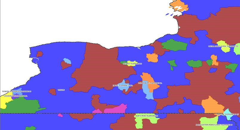
- Incumbent Phone Company territories
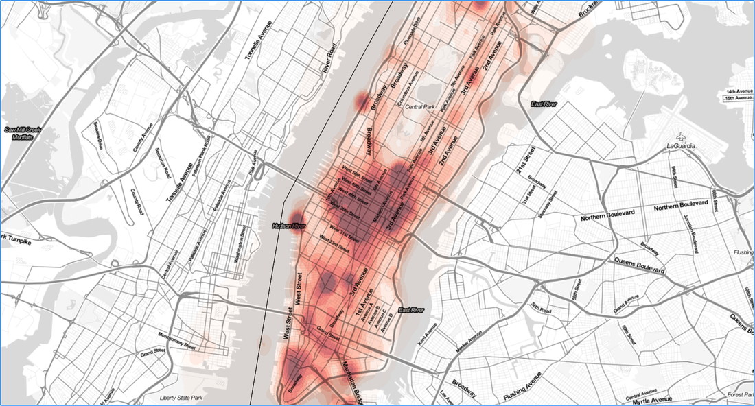
- Mobile Network Heat Maps, in total, by carrier and/or date/time periods
We have additional information that is not sourced from the usual places (crowd sourced), it can be used as an independent spot check and verification to state mapping projects which typically use carrier reported data. By using various data sources and GIS comparison processes, confidence factors for data accuracy can be established.
Broadband-Mapping.com can use other data sets for customized reports or studies such as proprietary internal customer lists. Comparing these additional sources of information can further add to the accuracy and precision of any market studies and conclusions. When you merge information sets with others like Zip Plus4 and IP address location data, one can begin to draw some interesting conclusions to comprehensively understand the marketplace and/or the competition.